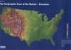
US & North American Maps of Different Earth Systems

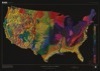
Maximum Temperature January Climatology (1971 - 2000)
Saturday, September 19, 2009
Source: Oregon State University’s Prism Climate Group. Click on the map to go directly to the original image.
Temperature color coding within the VFE database is drawn from the slightly different scheme used by the National Weather Service in its temperature maps.